Casual Strolls in Bay Area
Discover Bay Area’s Hidden Gems with me as Your Trail Guide!
Let me be your guide to the hidden treasures of the Bay Area’s breathtaking trails. Having hiked over 150 plus trails in the region, I’ve not only immersed myself in the diverse landscapes but meticulously documented each trail’s nuances to ensure you have the most enriching outdoor experience possible. Whether you’re a seasoned hiker or a novice adventurer, my focus is to provide you with detailed insights into each trail's difficulty, terrain, best time to visit, the availability of restrooms, parking details, and unique features. From shaded strolls to sun-soaked challenges, I’ve got you covered.
For your convenience, I've organized the trails into four categories: easy, moderate, hard, and walks based on their difficulty level. The ‘walks’ section is dedicated to gentle strolls with minimal elevation gain, perfect for those seeking a more relaxed outdoor experience.
Additionally, I've marked the trailheads on a map, categorized according to difficulty level. This feature makes it easier for you to find trails nearest to you or select hikes in a particular area, ensuring a seamless and personalized exploration of the Bay Area’s trails.
While hiking these trails, I made several observations that might be helpful for anyone interested in exploring them:
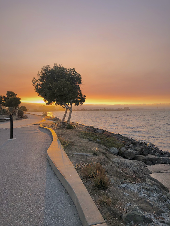
- Although some of these hikes may not be visually striking, I purposely timed 90% of them to coincide with sunset, which greatly enhanced the overall ambiance. The breathtaking sunsets and delicate pink hues created an indescribable atmosphere. My primary objective was to stay active, immerse myself in nature, and, most importantly, take time off screens to truly connect with the natural world.
- Regarding the debate of hiking in the morning versus the afternoon, I discovered that afternoons offered better chances of finding parking spots. I had always believed that mornings were the optimal time for hiking, but it turns out I was mistaken. Afternoons meant fewer crowds and readily available parking.
- I usually opted for hikes that had moderate to light foot traffic, avoiding heavily crowded ones, unless I visited on weekdays.
- Longer hikes mean fewer people. I noticed that longer hikes tended to have fewer people. Even when the parking lots were full, I rarely encountered more than ten individuals on such trails. I appreciated the tranquility and solitude of these hikes more.
- I heavily rely on Alltrails for its invaluable insights. While it’s a fantastic resource, I’ve noticed a slight variation in trail measurements—usually around 0.1 miles off, with minimal discrepancies in elevation gain. The free version of the app proved to be quite useful for navigating through all of these trails.
If you’re seeking outdoor activities to stay active, I’ve gathered a collection of excellent options for you. Below is a comprehensive list of hikes, complete with pertinent information and links to their respective AllTrails pages. All the trails mentioned in this list are either out-and-back or loop trails, except for the Dipsea Trail, which is a point-to-point trail, meaning it doesn’t conclude at the same starting point.
Happy Trails!
Easy Trails
Moderate Trails
Hard Trails
Walks
Expand the Legend on the left for trailhead details
Walks
- SF Bay Trail through Eden Landing- 4.6 mile, Elev Gain negligible
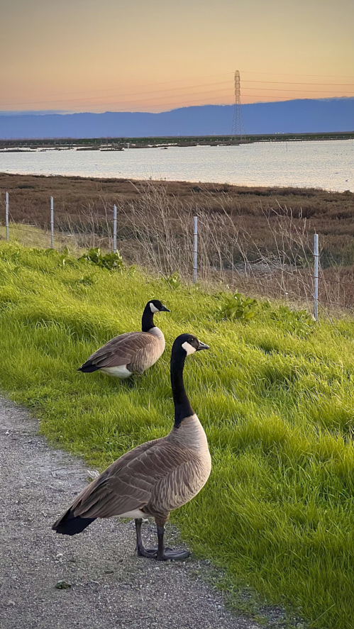
I recently visited the Eden Landing Ecological Reserve, a huge area with about 6,400 acres of restored ponds, marshes, and uplands. It’s a special place for birds and other marsh fauna. I walked along the Eden Landing Bay Trail, a nice path that goes around these wetlands. The trail is well taken care of, and you could walk here any time of the year to see wildlife. The walk was amazing, especially for bird watching. I spotted some cool birds like egrets, Canada geese, and even found a pretty white dapperling mushroom. It was a fantastic experience in this nature haven.
Parking: Available, Free
Restrooms: Yes, Portable toilets
Condition: No Shade, Must-do around sunset!
Location: Eden Landing Ecological Reserve, Hayward
 |
 |
- Tiburon Waterfront - 6 mile
The trail provides views of Angel Island, Sausalito, and San Francisco. Please do it around sunset; it’s gonna be gorgeous. It is often busy or crowded, particularly on weekends or peak hours. It is easy to traverse and great for kids, dogs, and bikes. Its closeness to Tiburon’s downtown area adds to the overall enjoyment of the experience, including the presence of eateries and historical elements. A passenger ferry service to Angel Island is available from downtown Tiburon. It is a part of San Francisco 500-mile Bay Trail.
Parking: Available
Restrooms: No
Condition: No Shade, Highly recommended
Location: Tiburon
- Bayshore trail - 5.3 mile
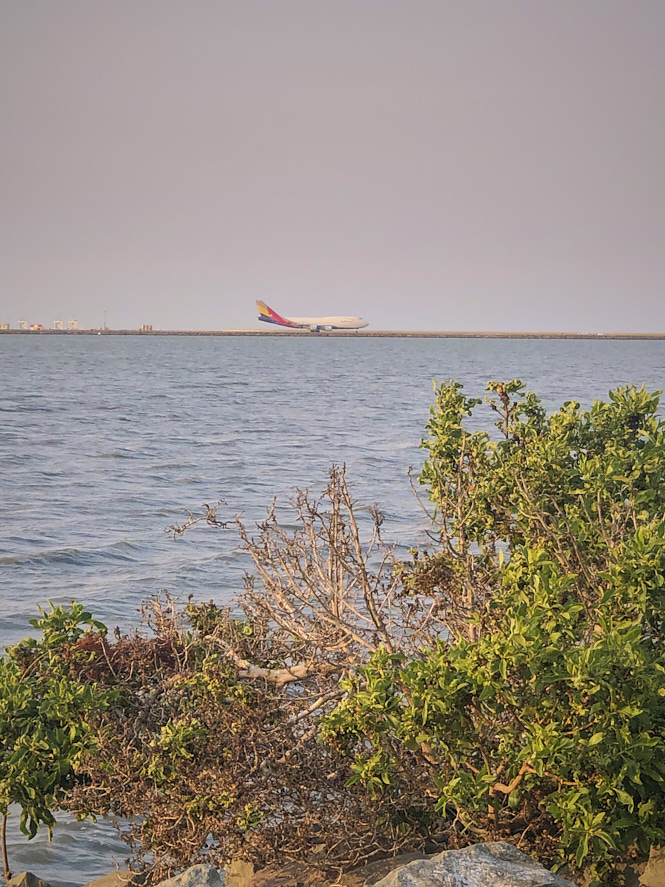
A small park situated alongside the bay and adjacent to the airport, featuring a leisurely walking trail and seating areas ideal for observing airplanes as they touch down. Amazing sunset views, if you choose, do it in the evening. Also, sometimes you get awesome views of the fog rolling in over the sweeny ridge. This trail constitutes a section of the extensive 500-mile San Francisco Bay Trail.
Parking: Available
Restrooms: No
Condition: No Shade
Location: Bayfront Park, Millbrae
 |
 |
- Cogswell Marsh Trail - 6 mile
6-mile walk is a relaxed walk, do it ideally around sunset for a breathtaking experience! Sunrise is gorgeous too. Lots of birds. I started from the trailhead near the Hayward Shoreline Interpretive Center (37.623556, -122.135750 street parking) instead of the one suggested by AllTrails, which proved to be a more convenient location for parking.
Parking: Available, Free
Restrooms: Available
Condition: No Shade, do it around sunrise or sunset
Location: Hayward Regional Shoreline
- Cooley Landing Trail - 3.2 mile
The walk is pleasant and ideal for unwinding after work. Also, fun to watch planes take off and land from Palo Alto Airport. Not too crowded on weekends. Sunsets will create a stunning backdrop for your evening stroll.
Parking: Available, Free
Restrooms: Available
Condition: No Shade, do it around sunrise or sunset
Location: Palo Alto
- Tennessee Valley Trail - 3.6 mile
The 3.6-mile walk at Tennessee Valley is relatively easy, but be prepared for limited shade along the trail. It’s a beautiful trail that provides excellent hiking opportunities with the chance to encounter a diverse range of wildlife. During my hike, I spot a coyote. It’s important to note that the trail tends to be heavily trafficked, especially on weekends. While the beach offers an incredible view during sunset, it can become overwhelmingly crowded.
Parking: Available, Free
Restrooms: Available, Vault toilet
Condition: No Shade, Avoid weeekends
Location: Marin Headlands
- Newark Slough Trail - 6.5 mile
The trail is a straightforward dirt path through the marshland, measuring just over 6.7 miles due to the recent road closure preceding the bridge. Despite its moderate level of traffic, I encountered not a single soul along the trail. Interestingly, there were individuals gathered at the trailhead and a few scattered around the hill, but to my surprise, the trail itself was deserted on a Saturday afternoon. It appears that other hikes and walks in the vicinity enjoy greater popularity. Nevertheless, it remains an excellent choice for an evening walk and birdwatching.
Parking: Available, Free
Restrooms: Available
Condition: No Shade
Location: Don Edwards National Wildlife Refuge, Newark
- Limantour Beach Trail - 5.4 mile
It’s a beautiful walk along the beach. One of the notable aspects of this beach is its vast width and length, making it a perfect spot for much-needed peace and relaxation. However, I must admit that I’m not particularly fond of long walks on the sand. If you happen to enjoy walking on sand, I would definitely recommend it. As I ventured further from the parking lot, I found ourselves with the beach all to ourselves, which was truly wonderful. One thing worth mentioning is that it was quite windy during my visit. This might be something to keep in mind when planning your trip. Also, please note Limantour Spit harbor seal pupping area (which is just a tiny portion of the trail) is closed to all entry from March 1 to June 30 of each year.
Parking: Available, Free
Restrooms: Available, Vault toilet
Condition: No Shade, Must-do!
Location: Point Reyes National Seashore
- SF Bay Trail and Oyster Bay Loop Trail - 3 miles
This trail next to Oakland airport has no shade and low foot traffic. Watching the planes take off, and land at Oakland Airport was exciting. Undoubtedly, the views along the way are breathtaking. However, there is a noticeable unpleasant odor at the trailhead, likely due to the nearby Waste Management plant. Fortunately, as you venture further from the trailhead, the smell dissipates. On a positive note, the trail leads to a picturesque spot ideal for admiring beautiful sunsets.
Parking: No designated parking, but you can park off Neptune Dr, Free
Restrooms: Available
Condition: No Shade, best for sunsets
Location: Oyster Bay Regional Shoreline, San Leandro
- Hamilton Wetlands - 4.4 mile, Elev Gain 49 ft
This hidden gem was truly wonderful! In the evening, it had a peaceful and beautiful atmosphere. Interestingly, Alltrails has recently associated it with the San Francisco Bay Trail and Hamilton Wetlands, creating a 9.6-mile hiking route. The trail now starts from Las Galinas Valley Parking lot. You can still enjoy this trail by doing a 4.4-mile round trip or or adjusting the distance as you prefer, skipping the remaining portion.
Parking: Available
Restrooms: Available
Condition: No Shade, best for sunsets and sunrises
Location: San Pablo Bay Wildlife Area, San Rafael
- Golden Gate Park Loop - 6.3 miles, Elev Gain Negligible
Golden Gate Park is a must-visit destination in San Francisco, offering a blend of natural beauty, cultural attractions, and recreational opportunities. Whether you’re interested in walking, exploring museums, or enjoying the park’s serene atmosphere, Golden Gate Park has something for everyone.
Parking: Available
Restrooms: Available
Condition: Mostly shaded
Location: Golden Gate Park, San Francisco
- Lake Merced Loop - 4.5 mile, Elev Gain 127 ft
The trail experiences heavy traffic, as it is a loop, there are multiple parking lots available, allowing you to begin your journey from any point along the trail. Much of the trail runs alongside a bustling road, completely paved and ideal for strollers or children riding bikes. However, if you seek a tranquil stroll, it might be preferable to opt for an alternative. The presence of significant road noise requires you to be prepared for a less peaceful experience.
Parking: Available
Restrooms: Available
Condition: No Shade, Paved, Stroller friendly
Location: Lake Merced Park
- SF Bay Trail: Roberts Landing to Marina Park - 6.6 miles
Experience a leisurely 6.6-mile stroll along the bay with no shade. Located near Oakland Airport, this trail offers a close-up view of incoming flights. While Marina Park tends to be bustling, the trail becomes super crowded during sunset. Don’t pass up the opportunity to hike this route and witness the magic of the setting sun.
Parking: Available
Restrooms: Available
Condition: No Shade, Paved, Stroller friendly
Location: Hayward Regional Shoreline
- Montclair Railroad Trail Shepherd Canyon- 3.1 mile, Elev Gain 253 ft
If you’re in the mood for a leisurely stroll surrounded by nature, this cute and easy paved trail might be just what you need. Located conveniently with street parking available, the trail offers a mostly shaded and paved path, making it perfect for a sunny day.
However, finding the trailhead was tricky. Navigating through the right stairs took some time, and AllTrails might not be reliable. Though, as a fully accessible ramp on La Salle provides a smooth entry point, ensuring everyone can enjoy this beautiful trail. The initial section may pose a challenge for strollers due to stairs, but once past that hurdle, the trail is suitable for dogs, kids, and strollers alike. I saw a lot of people with strollers.
Parking: Available
Restrooms: Available
Condition: Shaded, Stroller friendly
Location: Shepherd Canyon Park
- Napa River and Bay Trail - 5.7 mile, Elev Gain 43 ft
This park is a great spot for a relaxed walk and wildlife watching. The trail is partly paved, and it’s suitable for those with children as strollers can be easily used. It is a paradise for bird-watching enthusiast. My evening visit was special because I saw a beautiful sunset. The sky turned orange and pink, making the wetlands look magical. It made my already enjoyable outing even more enchanting. If you enjoy nature and easy walks, this place is a gem!
Parking: Available, Free
Restrooms: No
Condition: Unshaded, Stroller friendly
Location: Wetlands Edge Park
- Lake Merritt - 3.2 miles
It’s like a big circle around a beautiful lake, and it’s about 3.2 miles long. You can find nice paths, pretty bridges, and lots of green spaces. The lake itself is home to many birds, like ducks and geese. Sometimes, you might even see a heron! It’s a nice mix of city and nature, and it’s a cool place to visit in Oakland. Though keep in mind it can get pretty busy.
Parking: A dedicated parking area for the lake is not available, so you will probably need to find street parking.
Restrooms: No
Condition: No Shade
Location: Lake Merritt
- Redondo Beach via Coastal Trail Loop- 2.2 mile, Elev Gain negligible
This easy walk near Half Moon Bay has awesome views of the ocean, perfect for nature lovers. I did it on a weekend evening when it wasn’t too crowded. Parking was easy near the baseball field, right where the GPS took us.
Parking: Available, Free
Restrooms: No
Condition: No Shade, Must-do!
Location: Half Moon Bay
Expand the Legend on the left for trailhead details